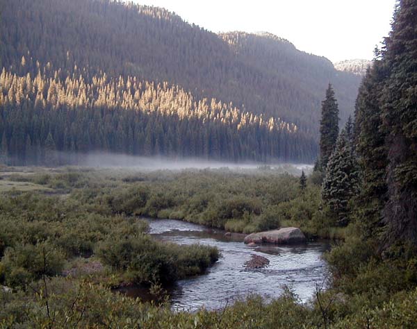
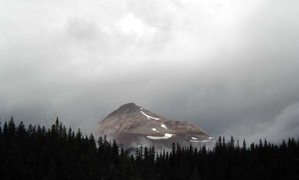
 This view of the
Los Pinos valley was taken from our campground across the river from Granite
Peak. The morning dawned clear and beautiful, with mist rising from the
river in the cool morning air. This view of the
Los Pinos valley was taken from our campground across the river from Granite
Peak. The morning dawned clear and beautiful, with mist rising from the
river in the cool morning air.
We packed up, and hiked down toward Flint Creek. Crossing the creek,
we noticed black clouds gathering over the peaks up the drainage, building
in our direction, and began to hear thunder and see lightning. We
stopped about a mile and a half up the creek, and fixed lunch. Our noon
meal is actually the big meal of the day, which we cook and do the dishes
for before resuming hiking. This serves several purposes.
It gives us a nice long break between the morning and afternoon hikes.
It refuels us for the afternoon hike. It is also the only meal of the day
we actually cook, eating trail food and snacks at night, and cold breakfast
food, which means that bears, which are attracted to cooking odors, are
attracted to the place we had lunch, rather than our camp! In country like
this, black bears, while present, are not much of a threat, but doing this
in grizzly bear country, like Wyoming and Montana, and thus not attracting
grizzly bears is something the prudent hiker tries with great diligence
to accomplish.
After lunch, we decided that being up on the divide was not the
prudent place to be, and we retreated down the Flint Creek drainage.
We headed back up the valley of the Los Pinos river. The storm caught
up to us, and dropped very cold rain and hail on us. We hiked on down in
the valley protected from lightning by the peaks and the lovely aspen forest
the trail wound through. It rained all afternoon, and on into the evening.
We kept hiking until after six o'clock, because hiking in the rain is
not noticeably less annoying that sitting in a small tent in the rain.
Eventually, we camped in a nice grove of pine trees, where it
was drier under the rain, crawled into our tent to warm up, and went to
sleep. |
 This page has a
lot of photographs on it, and may take a bit of time to load. I think the
pictures are worth the wait.
This page has a
lot of photographs on it, and may take a bit of time to load. I think the
pictures are worth the wait.
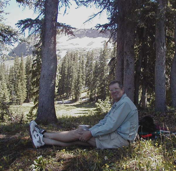 This is Lindy cooking
lunch at our camping spot at Squaw Pass, elevation 11,200 feet. In the
background just below the top of the mountain, the funny white stuff which
looks like snow is snow. The snow is around in places pretty much
all year.
This is Lindy cooking
lunch at our camping spot at Squaw Pass, elevation 11,200 feet. In the
background just below the top of the mountain, the funny white stuff which
looks like snow is snow. The snow is around in places pretty much
all year.
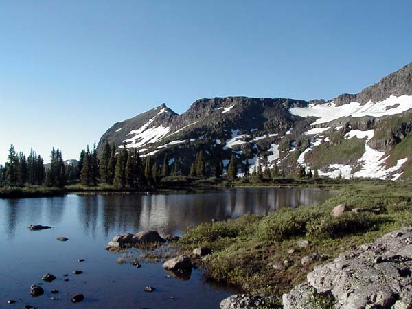 This is a lake
in a glacial cirque. There are four such cirques on the CD Trail north
of Squaw Pass. They are lovely camping places. A cirque is a bowl-like
depression carved into the face of the mountain by a glacier.
This is a lake
in a glacial cirque. There are four such cirques on the CD Trail north
of Squaw Pass. They are lovely camping places. A cirque is a bowl-like
depression carved into the face of the mountain by a glacier.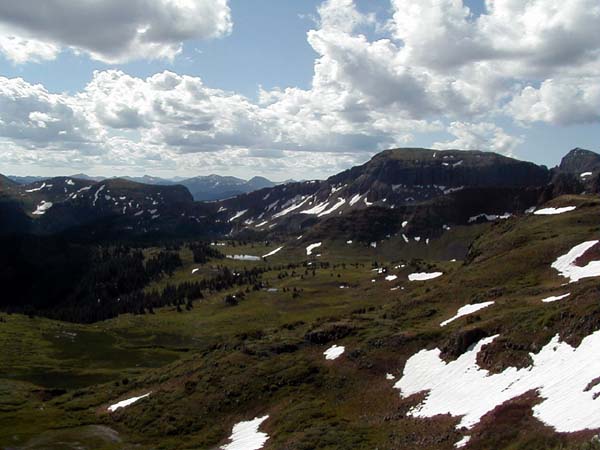 This view is looking
toward the south from the last of the glacial cirques as we climbed up
onto the continental divide itself. The trail has switchbacks which make
the climb easier.
This view is looking
toward the south from the last of the glacial cirques as we climbed up
onto the continental divide itself. The trail has switchbacks which make
the climb easier.
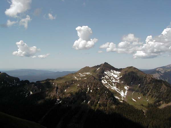 This is the view
from the high point in this section of the Continental Divide Trail, looking
to the west. The altitude at this point is about 12,830 feet.
This is the view
from the high point in this section of the Continental Divide Trail, looking
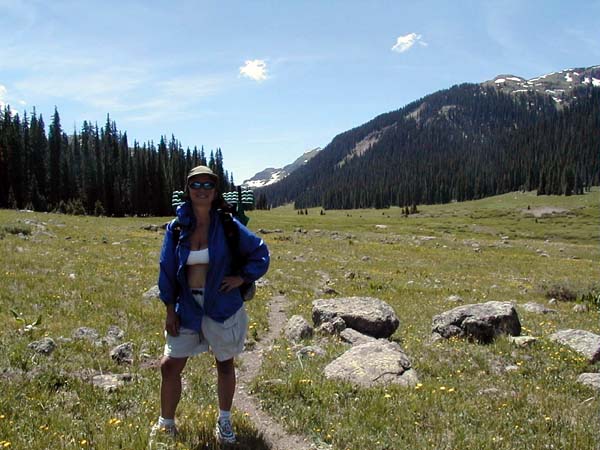
to the west. The altitude at this point is about 12,830 feet.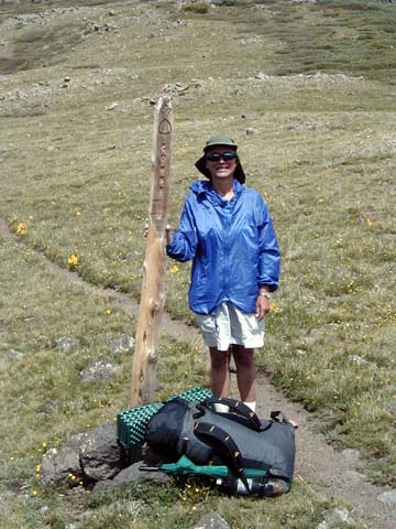 This is Lisa standing
with her pack next to a Continental Divide Trail marker near 12,400 feet.
Again, the trail is not very wide, but usually easy to follow. Markers
such as this one as usually found in locations near an intersection with
another trail, or in a place where the trail may be difficult to follow.
The marker has the trail symbol near the top, and the letters CDNST below,
which stands for Continental Divivde National Scenic Trail.
This is Lisa standing
with her pack next to a Continental Divide Trail marker near 12,400 feet.
Again, the trail is not very wide, but usually easy to follow. Markers
such as this one as usually found in locations near an intersection with
another trail, or in a place where the trail may be difficult to follow.
The marker has the trail symbol near the top, and the letters CDNST below,
which stands for Continental Divivde National Scenic Trail.
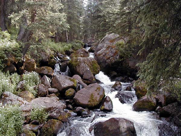 Once off the
high ground on the CDNST, we hiked down the north fork of the Los Pinos
river, and then down Weminuche Creek to get back to my truck. This is a
lovely section of a boulder-choked section of Weminuche Creek.
Once off the
high ground on the CDNST, we hiked down the north fork of the Los Pinos
river, and then down Weminuche Creek to get back to my truck. This is a
lovely section of a boulder-choked section of Weminuche Creek.
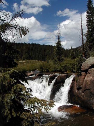 With our clothes
washed, our bodies rested, and our provisions restocked, we headed out
for the high country again. This is a lovel waterfall on the Los Pinos
river about four miles below Weminuche Pass. Our intent was to camp between
Weminuche Pass and the trail intersection with the Flint Creek drainage,
and the following day head up the Flint Creek trail to Flint Lake. There
we would camp overnight, and descend the next day along the CDNST back
to Weminuche Pass.
With our clothes
washed, our bodies rested, and our provisions restocked, we headed out
for the high country again. This is a lovel waterfall on the Los Pinos
river about four miles below Weminuche Pass. Our intent was to camp between
Weminuche Pass and the trail intersection with the Flint Creek drainage,
and the following day head up the Flint Creek trail to Flint Lake. There
we would camp overnight, and descend the next day along the CDNST back
to Weminuche Pass.
 The next morning,
we woke up, and outside it was cold. The storms had been generated by a
cold front, and it was thirty-six degrees F. outside, nearly ten degrees
colder than the mornings we had been experiencing.
The next morning,
we woke up, and outside it was cold. The storms had been generated by a
cold front, and it was thirty-six degrees F. outside, nearly ten degrees
colder than the mornings we had been experiencing.