 We parked the
truck at the parking lot for Shaw Lake, which is also the trailhead parking
for the Kitty Creek trail, which we intended to walk down from the Highland
trail, and walked down the road to the trailhead for the Hope Creek trail. We parked the
truck at the parking lot for Shaw Lake, which is also the trailhead parking
for the Kitty Creek trail, which we intended to walk down from the Highland
trail, and walked down the road to the trailhead for the Hope Creek trail.
The Hope Creek trail is pretty short, only 5.8 miles to the junction
with the Highland trail, but it climbs about 2500 feet in that distance,
so it's a nice aerobic workout. We stopped and had our big meal at a nice
place near water on the trail.
The trail winds up to a basin which was described as having some "nice
but exposed places to camp." That turned out to be a good description,
but we didn't get there the first day. As we climbed some switchbacks toward
that basin, lightning and thunder began to pop on the high peaks, and we
decided to descend to a more sheltered camping stop, and call it a day
- our experience has been that one thunderstorm is often followed by others.
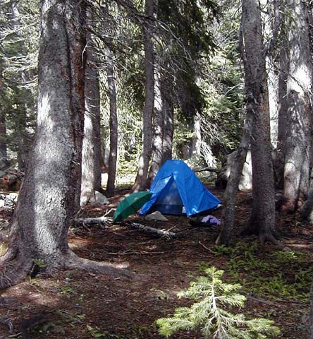
This is where we camped. We pitched the tent just as the rain started
to fall. After a bit, the rain quit and the sun came out. Lisa walked a
bit up the trail to do a watercolor sketch of a pretty creek scene nearby.
You will notice my green umbrella open to dry out in front of the tent.
Until I read Ray Jardine's book, I had never considered backpacking with
an umbrella. Now that I've tried it, I wouldn't consider backpacking without
one. An umbrella can provide needed shade in the sun. In a light or moderate
rain, it allows one to hike with one's rainjacket zipped open in front,
providing much-needed ventilation as well as keeping one's pack much drier,
although the latter function is not really necessary, as everything in
it which water might bother is in a plastic bag.
Lisa and I both have umbrellas made by GoLite, which are sturdy but
lightweight.
The sun, as you can see in the picture above, did come out after the
thunderstorm, so we could have resumed hiking. Well, actually, no. We were
pounded by two successive sets of thunderstorms after the first one, with
lightning striking with a quarter of a mile up on the ridgeline above us,
so our decision to stop when we did was correct.
My experience has been that a decision to stop early is rarely wrong,
and decisions to go on in the face of a threat of lightning at high altitude
is not often right. The consequences for making the less-safe decision
can be severe. |
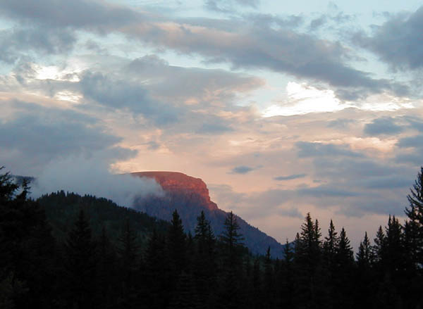 This picture wasn't
taken from a trail, but instead was taken from a Forest Service campsite
just south of the falls on North Clear Creek, which is between Creede and
Lake City, Colorado. The mountain in the picture is known as Bristol Head.
It had been raining a bit before the sun set.
This picture wasn't
taken from a trail, but instead was taken from a Forest Service campsite
just south of the falls on North Clear Creek, which is between Creede and
Lake City, Colorado. The mountain in the picture is known as Bristol Head.
It had been raining a bit before the sun set.
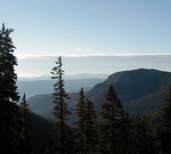 This is a view
to the east and a bit south as we climbed up the trail the next day in
the early morning light.
This is a view
to the east and a bit south as we climbed up the trail the next day in
the early morning light.
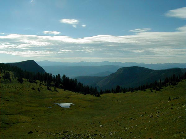 This is the basin
we were climbing toward the afternoon before when we were turned around
by a thunderstorm. As you can see, though it has lovely views, it is indeed
very exposed.
This is the basin
we were climbing toward the afternoon before when we were turned around
by a thunderstorm. As you can see, though it has lovely views, it is indeed
very exposed.
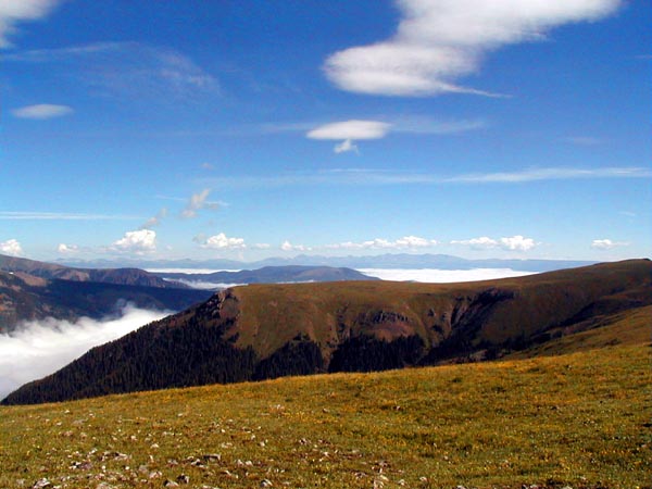 This is a view
from the top of the Highland trail of lovely alpine meadows, and what lies
below. These valleys to the west and north are shrouded in clouds, but
up where we were, the views were stunning. The trail up here was easy to
follow for a while, but eventually disappeared completely, and was replaced
by a line of rock cairns. A cairn is simply a pile of rocks, sometimes
but not always supporting a wooden post. To follow the "trail", one just
walks from one cairn to another.
This is a view
from the top of the Highland trail of lovely alpine meadows, and what lies
below. These valleys to the west and north are shrouded in clouds, but
up where we were, the views were stunning. The trail up here was easy to
follow for a while, but eventually disappeared completely, and was replaced
by a line of rock cairns. A cairn is simply a pile of rocks, sometimes
but not always supporting a wooden post. To follow the "trail", one just
walks from one cairn to another.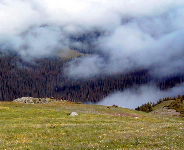 Barely visible
in this picture is a herd of elk right on the ridgeline. We stood quietly
watching them for a brief time, and I was able to get this picture. When
we started walking again down the trail, they evidently decided we represented
a threat and disappeared over the ridge toward the valley below. Elk in
this country are hunted, so they have good reason to fear man.
Barely visible
in this picture is a herd of elk right on the ridgeline. We stood quietly
watching them for a brief time, and I was able to get this picture. When
we started walking again down the trail, they evidently decided we represented
a threat and disappeared over the ridge toward the valley below. Elk in
this country are hunted, so they have good reason to fear man.
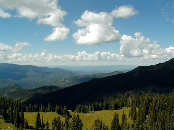 This picture
was taken from the Continental Divide trail up above Wolf Creek Pass, in
fact just to the west of the Wolf Creek Ski Area. We parked the truck in
the pass, and did a short day hike - about four miles round trip with 2000
or so feet of elevation change.
This picture
was taken from the Continental Divide trail up above Wolf Creek Pass, in
fact just to the west of the Wolf Creek Ski Area. We parked the truck in
the pass, and did a short day hike - about four miles round trip with 2000
or so feet of elevation change.