 The Uinta mountains
is one of only two major mountain ranges in the U.S. which is oriented
east-west rather than north-south, the other being the Brooks Range in
Alaska.
The Uinta mountains
is one of only two major mountain ranges in the U.S. which is oriented
east-west rather than north-south, the other being the Brooks Range in
Alaska.
If solitude is what you are seeking, I recommend the Brooks Range, where the population of ursus horribilis, i.e., grizzly bears, exceeds that of humans. Keep in mind, though, that in that range humans are part of the food chain, and not the top of it, either.
The Uinta Wilderness encompasses 457,000 acres of the mountains, and lies east of Salt Lake City, Utah. Parts of it are hugely popular with the residents of Salt Lake, who visit it heavily but mostly on weekends, and mostly within 5 miles of a trailhead. Get further from that from a paved road, and you'll be mostly alone.
If you saw the movie Jeremiah Johnson, in which Robert Redford played a mountain man, you've seen some of the Uintas, as it was where much of the movie was filmed.
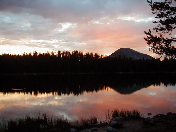
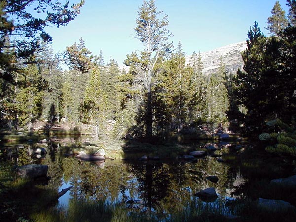
This is Teapot Lake, right behind the Lilly Lake campground on Utah highway 150, which runs from Kamas, Utah, to Evanston, Wyoming. On the left side of the picture, you will find a ring in the water where a fish of some kind had just risen to eat something. The lake is popular with fisherpersons.
 This is also Teapot
Lake. I've no idea why it is named that.
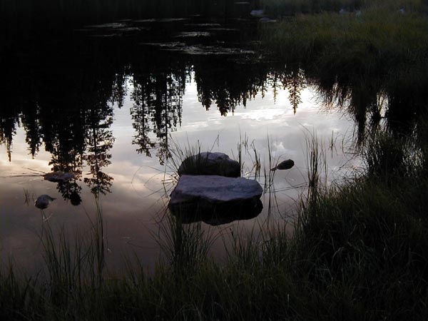
This is also Teapot
Lake. I've no idea why it is named that.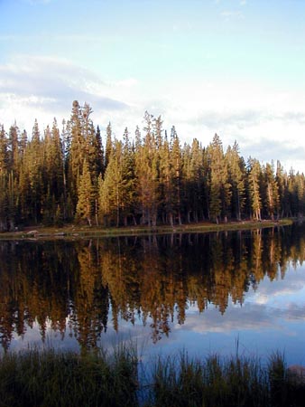 In his book Mountain
Light, photographer Galen Rowell referred to the hour around sunset
and the hour around sunrise as "the magic hours". I think you can see why.
In his book Mountain
Light, photographer Galen Rowell referred to the hour around sunset
and the hour around sunrise as "the magic hours". I think you can see why.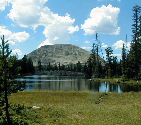 I went for a walk
up the hill one day, and found this other lovely lake. It was high enough
up that I didn't linger long, as storm clouds were forming.
I went for a walk
up the hill one day, and found this other lovely lake. It was high enough
up that I didn't linger long, as storm clouds were forming.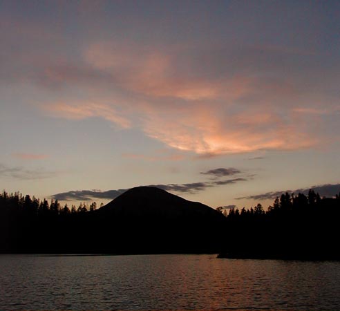 There are probably
people who get tired of looking at the mountains and the sky in the evenings.
I am not one of them.
There are probably
people who get tired of looking at the mountains and the sky in the evenings.
I am not one of them.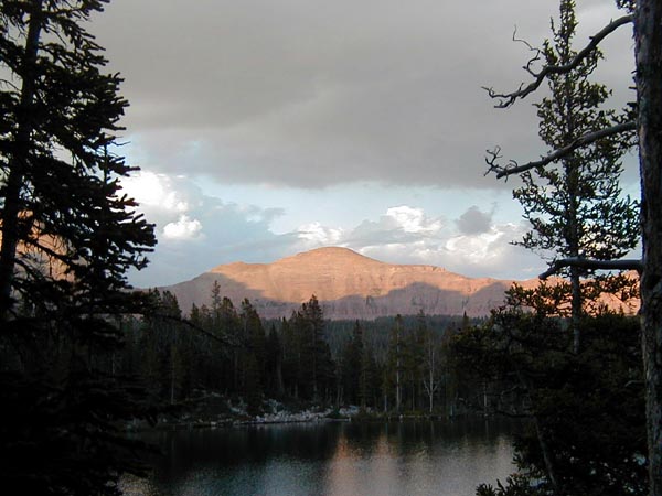 I decided to go
explore the upper basins of the Rock Creek drainage, so I packed my stuff
and hiked in from the Highline trailhead, about 8 miles over Rocky Sea
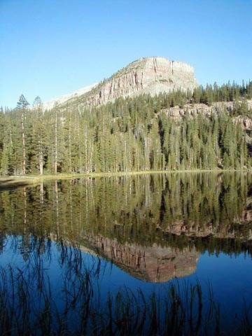
Pass. This is Black Lake. I saw several groups of people going into the
area to the west of the pass, many doubtless headed for Naturalist Basin,
which is pretty but heavily visited mostly because it's only six miles
from the trailhead.
I decided to go
explore the upper basins of the Rock Creek drainage, so I packed my stuff
and hiked in from the Highline trailhead, about 8 miles over Rocky Sea
Pass. This is Black Lake. I saw several groups of people going into the
area to the west of the pass, many doubtless headed for Naturalist Basin,
which is pretty but heavily visited mostly because it's only six miles
from the trailhead.
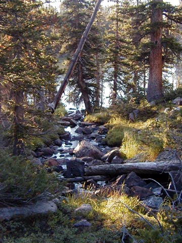 But, you ask,
why go walking in the wilderness at all?
But, you ask,
why go walking in the wilderness at all?
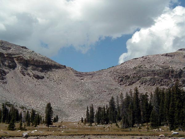 This is Rocky Sea
Pass, viewed from the east side of the pass. You can see why it's named
Rocky Sea, as it is a sea of rocks. It's not hard to walk over, though,
as the trail is very plain, and the drops off the trail are not dangerous.
One just needs to be careful where one is placing one's feet.
This is Rocky Sea
Pass, viewed from the east side of the pass. You can see why it's named
Rocky Sea, as it is a sea of rocks. It's not hard to walk over, though,
as the trail is very plain, and the drops off the trail are not dangerous.
One just needs to be careful where one is placing one's feet.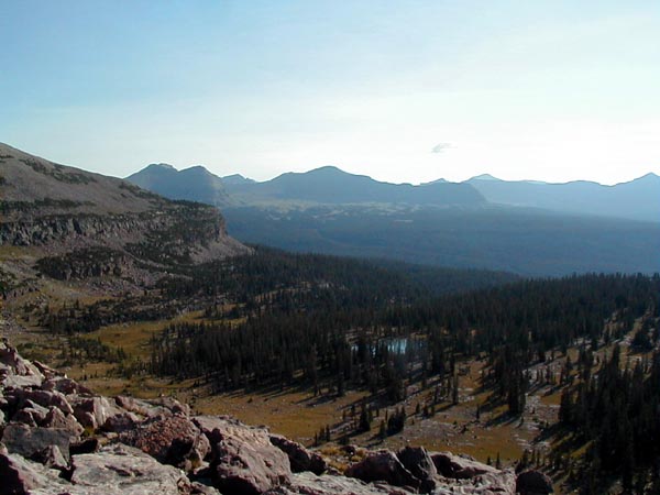 This is a view
of the Rock Creek drainage from hear the top of Rocky Sea Pass. At this
distance, one can barely see the open parks at the base of the mountains
which are one of the area's nicest features. The area above the Highline
Trail is about 7 miles across and perhaps 5 miles in depth. There may have
been other people in it when I was there, but I didn't see them.
This is a view
of the Rock Creek drainage from hear the top of Rocky Sea Pass. At this
distance, one can barely see the open parks at the base of the mountains
which are one of the area's nicest features. The area above the Highline
Trail is about 7 miles across and perhaps 5 miles in depth. There may have
been other people in it when I was there, but I didn't see them.