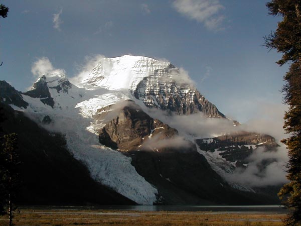
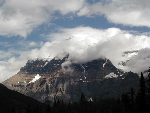
The Berg Lake Trail
or
What Happened to Sloth and Indolence?


Most of the pictures in this section are linked to bigger versions, with one exception, the picture of Berg Lake.  Click on the picture to get to the bigger version, then use your browser "back" button to get back to this page.  There are, in some pictures, differences between the "thumbnail" and the big picture.
 
This is Mount Robson, as viewed from the south side of the mountain, behind the Visitor's Center in Mount Robson Provincial Park in British Columbia, Canada.  The park is a bit east of Jasper, Alberta, on the western side of the Canadian Rockies.  It isn't a very good picture, because the summit is not clearly visible, but because the mountain makes its own weather, it can take a lot of time to view the summit from this angle.  That's because air bearing Pacific moisture must rise over the summit as it moves east, and the colder temperature around the summit causes these clouds.

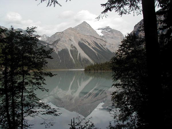
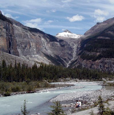
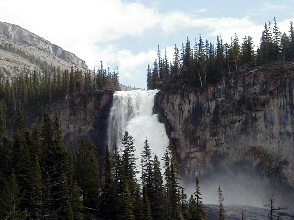
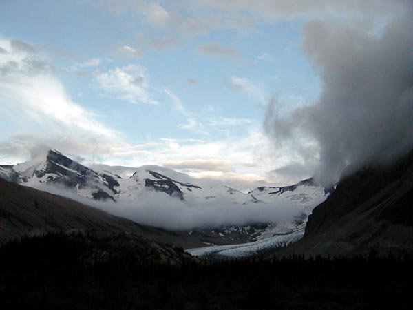
Mount Robson is the tallest peak in the Canadian Rockies, and it is spectacular in that it rises about 10,000 feet above the point where this picture was taken, near the trailhead for the hike.  Because of this vertical rise, the views of the mountain from the trail are wonderful.  The Berg Lake trail, which runs around the west side of the mountain up to Berg Lake, is extremely popular - in one recent year 11,000 people registered for overnight hikes on the trail - so it's on a quota system which limits the number of people who can camp on the trail at any given time.  Details and reservations can be had by calling the park at 604-566-4325.

The number of reservations is limited to a partial set of the total, and the remaining camping spots on the trail are released at noon each day for the following day(s).  So, on Tuesday at noon, I got my spots at Robson Pass reserved for Wednesday and Thursday nights, at the visitor center.

There are seven campgrounds on the trail, with a total of about 75 places to pitch a tent.  The table below lists each of the campgrounds, it's distance from the trailhead in miles, and the elevation in feet. The trailhead is at 2828 feet.
 
 
Campground
Distance from Trialhead
Elevation
Kinney Lake 4.2 3231
Whitehorn 6.5 3700
Emperor Falls 9.3 5351
Marmot 10.8 5400
Berg Lake 12.2 5400
Rearguard 12.6 5400
Robson Pass 13.4 5413

 
Kinney Lake is a popular day-hiking destination, as it's not very far from the trailhead, with the south end of the lake a bit more than three miles from the trailhead, and there isn't much rise in the trail.  This picture is of Kinney Lake.  In the bottom middle of the thumbnail, you can see a bench with my pack sitting on it.  Since I had no one with whom to split the weight of a tent, stove, and cooking gear, that pack weighed about 50 pounds, because I had to carry enough warm gear to survive if the weather turned cold - and that happens.  Temperatures well below freezing and several inches of snow are possible, even in "summer" months, though uncommon, but the prudent hiker prepares for what could happen, rather than what is likely to.

 The lake is quite long, perhaps a mile, and the trail follows its shoreline to the east.

There is some bad news embedded in that table above.  It's only 2.8 miles from Whitehorn to Emperor Falls, but the trail rises 1651 feet in that distance.  That means you go up almost at the rate of one foot for every 9 horizontal feet in that distance, and let me tell you, that's steep, particularly since some parts of that distance are level or downhill!

I was seriously tired when I got to Emperor Falls, and I still had four miles to hike.  Were I doing that again, I'd split that distance into two days.


This is the Robson River at the Whitehorn Campground.  A couple of hikers are cooling their feet in the cold, glacial water of the river.

Kinney Lake, Whitehorn, Berg Lake, and Robson Pass have shelters for cooking in the rain, which is very convenient, as the normal weather pattern is rain from the late afternoon into the night, with clearing in the morning - sometimes rather late in the morning.  Again, this is the west side of the Rockies, and that's the norm.  Firewood is also supplied in some places, at great effort by the park staff, and campers are encouraged to use it sparingly.  Conservation is also encouraged by the fact that its supplied in the form of logs, and campers have to saw it to length and split it for the fire.  At the higher levels, a campfire on a drizzly evening is a great comfort.  I normally don't like campfires, preferring to look at the stars, but when it's raining...

All of the camps have bearproof (bear resistant?) food storage, which in most cases is a tall pole with pulleys and ropes which one uses to hoist bagged food out of the reach of bears.  While it may stymy the bears, at Robson Pass, it didn't stop the efforts of a pair of pine martens, a weasel-like creature with black fur, to get into some of the food.


This is Emperor Falls, as viewed from the main trail.  The height of the trees in the picture provide a clue to how high the falls are.  There is a side trail which goes to the base of the falls from the left hand side of the picture, but because of the blowing spray visible in this picture, it's hard to get a good picture of the falls from there - and I tried.  It's nice on a warm day, though.

The picture below is what everyone hikes up 12 miles laterally and 2800 feet up vertically to see - the north face of Mount Robson at Berg Lake, called that because Berg Glacier calves into the lake.  It's unusual to see the summit that well - I was lucky to catch it on a clear morning.


This picture is a view of Robson Glacier, which starts on the northeast face of the mountain, and runs north and then to the west around a lower peak called Rearguard, from which the name of one of the campgrounds is taken.  Rearguard is the peak seen on the right side of the picture.  The view is up toward Snowbird Pass.  There is a trail from near the Robson Pass campground up to Snowbird Pass, which I originally intended to dayhike on Thursday from my camp at Robson Pass, but my feet were sore enough that I decided to give them a break, as the trail is almost 7 miles each way, with a significant elevation gain.

There are several dayhikes which could be taken from any of the high campgrounds near the lake.  The next time I do that trail, and I will do it again, I will schedule two days to get up to the lake, and several days there, to do day hikes.

On my rest day in camp, I sat by the fire and chatted with other campers.  There were two couples who were all active or retired Canadian schoolteachers, who had been up in the area before, and we conversed about dayhikes in the area, school systems, and life in general.

For a sidebar on modern backpacking gear "Cotton Kills Above the Timberline", click here.

There was also a family who had been there for 12 days, a physicist from the university at Boulder, Colorado, his wife, who had attended the University of Texas while I was there, and their two children.  They had flown in by helicopter with the mountain of food and equipment it takes to maintain a family with hungry children for that length of time.  The physicist and the kids were hiking out the same day I left, while the wife would fly out with the gear.  Helicopter flights are permitted into a pad near the Robson Pass campground only on Mondays and Fridays.  I have a bias against those flights - but they do allow people who couldn't get up the trail to visit the area.  One of the teachers who was there has a bad back, which doesn't permit him to carry a load, and he would be otherwise unable to see that country, but he can dayhike in the area.  His plight, and those of similar people, gives me some sympathy for that helicopter operation I would otherwise lack.  Some.

One would think that the hike out, mostly downhill, would be much easier than the hike up.  It wasn't.  Going downhill is nearly as tiring as going uphill, though it tends to be faster.  I got down the mountain from Robson Pass in 8 hours, while it took me about 10 hours to get up.  After drying out the gear and putting it away, I ate a huge dinner, and went to bed early.  I didn't have as much muscular soreness the next day as I did after the Harding Icefield trail, but my feet hurt more, since even strenuous aerobic training won't get your feet in shape for a 50 pound load.  I'm going to be working on that doing some day hikes in Alberta.

It was marvelous.  As always in this kind of country, the pictures don't begin to do it justice.

I'll be back.


Copyright 1999 by Linden B. Sisk
All rights reserved.

home

email: Lindy@arcanamavens.com