We didn't have as much time this year to spend hiking and goofing off in the mountains, because the girls had jobs this summer - Hallelujah! What we had was three weeks in July.
As you may have heard or seen on the news, Colorado had some terrible fires this year, as did other states in the southwestern U.S. because of a drought which brought a much lower than usual amount of snow to the moutains over the winter. Some of the places we normally go hiking were closed to overnight stays because of the fire danger, which included parts of the Weminuche wilderness and all of the Rio Grande National Forest, where camping was allowed only in developed (drive-in) Forest Service campgrounds. I suspect that latter restriction was so that the Forest Service would know where people were in the event they needed to be evacuated because of a fire.
Because of that, and because this was really a painting trip for Lisa, which meant she needed to carry her painting gear while we were hiking, this year we did only day hikes. That meant we would typically hike a few miles and one or two thousand vertical feet into some pretty spot, Lisa would do a painting, and we would hike out in the same day.
We drove the first day to Amarillo, which is about 620 miles from where we live. The second day we drove to South Fork, Colorado, an easy and pretty 400 or so miles. I always enjoy the drive on U.S. 64 between Dumas and Raton - the area is high, cool, and seems to get plenty of rain even in a dry summer, so it's usually green. South Fork is on U.S. highway 160, between Alamosa and Pagosa Springs, on the side east of Wolf Creek Pass. There is a major construction project underway at the pass, involving 40 minute delays, so we didn't go over the pass on this trip.
South Fork had a forest fire within less than a mile of town, but it
had been put out the week before we arrived. South Fork has a very nice
commercial campground right on the Rio Grande river just east of town where
we often stay. Lisa has done several paintings along the bank of the river.
|
|
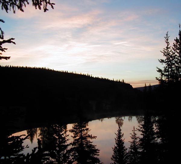
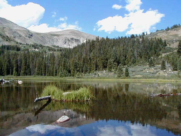
This was one of the lakes at the Deer Lake Forest Service (hereafter
FS) campground, a few miles down FR 788, which turns to the north off Colorado
149 just below the summit of Slumgullion Pass. FR 788 is a nicely graded
dirt road, suitable for ordinary automobiles. There are two lakes there,
and a lot of fisherman make day trips up from Lake City, just a few miles
to the north. One early-morning party mentioned that they came up hoping
to see some moose which were said to be in the area. We didn't see any.
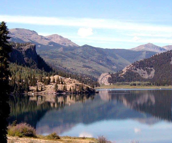 |
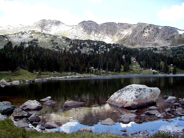
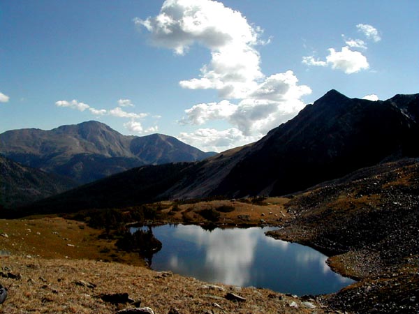
This is Lake San Cristobal, which is fed by the Lake Fork of the Gunnison
river, just a few miles outside of Lake City. There is a nice county campground
on the lake, Wupperman campground, elevated well above the lake level,
and with lovely views of the mountains and the lake. The picture was taken
just down the road from the campground on a morning when I hiked down to
the end of the lake to get some exercise and altitude acclimatization while
Lisa was painting. A couple of days at altitudes of 6,000 to 8,000 feet
are recommended to minimize the danger of acute mountain sickness (AMS)
before spending much time above 9,000 feet. Virtually all of this trip
was spent above 9,000 feet except when we were moving from one place to
another. Lisa developed a severe headache on a previous trip into this
area while we were hiking, and we wanted to make sure not to have that
happen again.
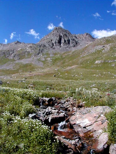 |
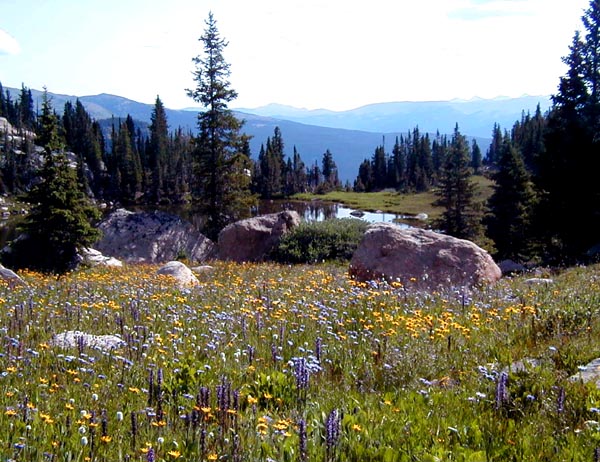
This is American Basin, which lies perhaps 12 miles up the Alpine Loop road above Lake San Cristobal. The 8 miles of the road above the abandoned Sherman townsite are shown on my map to be suitable for "high-clearance two-wheel-drive vehicles." Another trail guide I have describes that stretch of road as suitable only for 4-wheel drive vehicles, a rating I consider more accurate. We got up the road in my Dodge truck, but we had to go very slowly over some quite sizable rocks in the roadway. On the way up to the basin, we passed the trailhead for Silver Creek, from which one can access Redcloud and Sunshine Peaks.
The stream in the picture is running, as you can see, and there were
lots of wildflowers in the basin despite the drought. And, yes, the sky
really is that blue. The trail into the basin continues on up to the top
of Handies Peak, one of the Colorado peaks over 14,000 feet, known in the
state as "The Fourteeners." We were just getting used to the altitude,
so we walked from the trailhead a few miles up to Sloan Lake at about 12,900
feet. It's a lovely hike, with an easy, well-marked trail and great views.
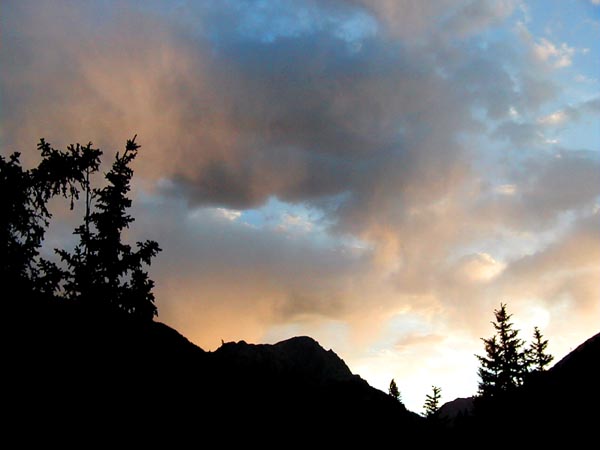 |
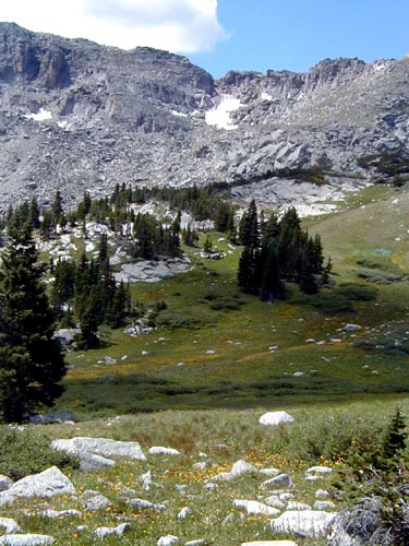
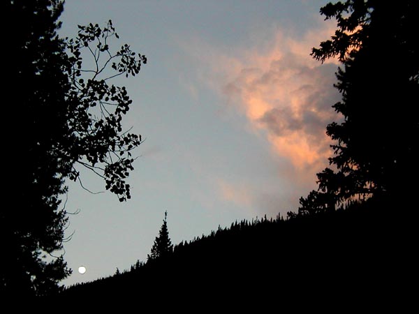
After the hike up into American Basin, we spent the night at the Mill Creek FS campground just east of Sherman townsite. The next day, Lisa painted, and I goofed off. The campground is at about 9600 feet, so we were getting more altitude acclimatization. This picture was taken at sunset looking up the river valley to the west. And, yes, the sky really is that blue...
The next day was my birthday, so we drove over to Ouray for lunch. There
is a very good Mexican restaurant in town now, and we ate outside on their
lovely patio. Despite the altitude in Ouray, around 7700 feet, it was warm
in the sun. After a brief respite wandering about the many stores and galleries
on the main street in town, we walked down to a shop on the south end of
main street which sells locally made ice cream. I've been stopping in the
place for years. They rotate flavors on a yearly basis, because they can
only make so many different kinds. This year, for the second year in a
row, they did not have my favorite, which is Blueberry Cheesecake, but
what they did have was delicious.
 |
After lunch in Ouray, we drove down to the state park at Ridgeway Reservoir. The water level in the reservoir was so low that they had closed the swimming area. We have camped there before, but because this was a weekend, there were a lot of families in the park, and some were pretty noisy. They did finally quiet down enough for us to get a good night's sleep. The park is very nice, and even has laundry machines, so we were able to get our clothes washed, but we'll probably choose to be elsewhere on weekend nights in the summer to avoid the crowds. None of the FS campgrounds we were in on this trip were near their capacities, and they always seem to be quieter. Of course, most are down dirt roads which get less traffic. The picture above is at sunset over the reservoir.
During the afternoon, we could see the smoke plume from a day-old fire over near the town of Norwood, which is north of Telluride. After the sun set, we could see the reflection of the flames under the smoke. It's not a reassuring sight.
The next day, we drove over to Gunnison, and then on up to Taylor Park Reservoir. The road is paved all the way up to the reservoir, but this year they had torn some of it up to rebuild it. We stayed at the Dinner Station FS campground a few miles up the dirt road above the reservoir. It's a very nice campground, right on the Taylor River, but because of the katabatic winds which develop late at night as the air cools on the mountains, it gets quite cool early in the morning because the cooler, denser air flows right down the watercourse. It got down to 32 degrees both nights we were there.
The next morning, Lisa painted. I took my mountain bike, and rode a few miles up to the abandoned Pieplant Mine site, about a thousand feet up in elevation. The descent down the dirt road was, well, quite exciting - I can see how people get hooked on that kind of riding - but I was glad that my bike had good disk brakes on it.
The following day, we packed up and drove over to Tincup for breakfast at Frenchy's Cafe in Tincup, which has great breakfasts. The road from the reservoir up to the town is a well-graded dirt road, and the town, which at one time had 6,000 miners living in it, is quaint. After breakfast, we drove up to Mirror Lake, where there is a very nice FS campground. The road up to the lake is pretty rocky and rough, but the clearance on it is OK, and the road is only about three miles long. The lake is very pretty, and Lisa has a good painting of it. In the afternoon, we hiked up the jeep trail to Tincup Pass, on the continental divide at 12,068 feet.
The next day, we drove back down to Frenchy's for breakfast, then on over Cottonwood Pass to recon the trailheads into the Collegiate Peak wildnerness. Colorado, by the way, has 36 officially designated wilderness areas, with more than 3 million acres. An excellent guide to them is The Complete Guide to Colorado's Wilderness Areas, by John Fielder and Mark Pearson.
We hadn't had showers since leaving Ridgeway Reservoir, so we drove on into Buena Vista, to look for a commercial campground. We didn't find one we liked, so we drove up to Leadville, which is less than 30 miles away, where we knew there was a good one, which is just below Turquoise Lake. The campground has an ice cream social every evening at 8:00 - all the ice cream you can eat for a buck if you bring your own spoon and bowl. Hmm, there seems to be a theme here involving ice cream...
The next day, we drove up the Hagerman Pass road to a trailhead, and
hiked up to Windsor Lake.
 |
This is Windsor Lake. The trail up to it is short - not much more than a mile - but steep, nearly a thousand feet, which calculates out to an average 20 percent grade. Some of it is much less than that, so some is much more. It is, as you can see, worth the walk.
Beware, though, that there are actually two lakes - the first one is
smaller than the one above, though quite pretty, and you can't see the
big one from the small one, because the big one is higher.
 |
This is a veritable riot of wildflowers. The smaller, lower lake is
just visible over the rocks in the center. Lisa did a very nice painting
of the lower lake.
 |
This ridgeline is the continental divide above Windsor Lake. Yes, the white stuff up on the ridgeline is snow, and, yes, the sky really is that blue.
The next day, we drove back down to Buena Vista, then up the Cottonwood Pass road to the Collegiate Peak FS campground. Cottonwood Pass road is paved from Buena Vista to the summit, then a very nicely graded dirt road down the other side of the divide to Taylor Park. Because the road is paved, and because it is quite near several good trailheads, the campground gets a lot of traffic from commercial groups composed mostly of college kids. They tend to make a lot of noise, so avoid the western end of the campground where there are two camp sites intended for groups. Also, the well tends to have silty water in it, though the water is regularly tested and is fine. The city park in Buena Vista has water faucets, where we refilled the 6 gallon jug I carry in the truck.
In the morning, we walked up the road to the Denny Creek trailhead.
From that trail, one can go three ways - to Hartenstein Lake, to Browns
Pass on the divide, or to the summit of Yale Peak. Because of the multiple
destinations, there is a lot of traffic from that trailhead, but there
is plenty of parking if you drive up to the trailhead. We went up to Hartenstein
Lake.
 |
The lake is formed by a beaver dam, which I was perched on somewhat precariously when I took this picture, looking west up toward the continental divide. There were a couple of groups, one family and one group of teenagers with leaders, camped around the lake. And, yes, the sky really is that blue.
We took the next day off. We went into Buena Vista, ate Mexican food, and browsed the shops, including a book store, where we bought Lance Armstrong's book _It's Not About the Bike_. Lance, in case you missed the news, has now won four times in a row the Tour de France bicycle race - a race of more than two thousand miles in three weeks through the countryside and mountains.. The book, though, is about his battle with cancer. He had not won the Tour before he was diagnosed with cancer. One of his doctors gave him a three percent chance of surviving the cancer, though he didn't tell Lance that until afterwards. Only four other men have won the Tour as many as four times. How Lance survived, and rebuilt his body into the cycling wonder that it is, is truly an inspirational story, even if you know nothing about bicycle racing. I highly recommend the book.
The next day, we drove up to the trailhead for Ptarmigan Lake.
 |
This, actually, is not Ptarmigan Lake, but a smaller lake below it. The hike was easy, and there are several smaller lakes a couple of hundred feet lower, below the treeline, which would make an excellent place to camp overnight. Of the three peaks in the group on the left, the higher one in the center is the aforementioned Yale Peak, several miles away across the valley. There were several fat marmots in the area around the lake, as well as some pikas in the rocky pass above the lake. Lisa sat down to do a painting, and I hiked up into the pass. I fired up my GPS receiver to see how high I was, and noticed on the map screen that we were only three miles or so from Mirror Lake. I thought it might be fun to hike between Mirror Lake and Ptarmigan Lake. When I got back to camp later and pulled out the appropriate map, I discovered that because of the steepness of the terrain between them, you can't hike directly, but have to go several miles out of your way to reach an appropriate pass. Rats. Of course, those with technical climbing skills could take a more direct route, but that's not how I care to spend my time.
We went back to camp, and got a brief but vigorous thundershower, follwed
by this spectacular sunset as the full moon was rising.
 |
The next morning, we were planning to leave the Collegiate Peaks campground, go into Buena Vista, and explore the area to the south down toward Mount Princeton and Agnes Vail Falls. Oops - as we were packing up, the campground host came by with the news that the storm the previous evening had caused a mudslide which closed the road into Buena Vista - several people making day trips to the east had been unable to return to camp overnight, and the road was still closed. We found out later that it stayed closed that day, as there were cars trapped in the mud, requiring rescues as well as road clearance. No one was seriously injured, although one elderly couple was treated for hypothermia after being trapped in the mud.
So, instead of going east, we went west over Cottonwood Pass back to Taylor Park. We stopped at the cafe at the reservoir, and ate a huge buffet breakfast. One nice thing about hiking and camping at high altitudes is that you can eat everything in sight without gaining weight. I lost about 8 pounds on this trip.
Then we drove over Cumberland Pass into Pitkin. I don't recommend that
road - it's very rough and takes forever. The road below Pitkin is paved,
though, and we drove into Gunnison, down through Lake City, and stopped
for the night at the Siverthread FS campground below Spring Creek Pass.
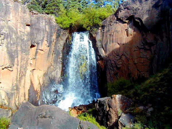 |
This is south Clear Creek Falls, which are right behind the campground. The picture does not do this scene justice - it's a very pretty falls.
The next day, we drove down to Chama, New Mexico. We had never been down the road, highway 17, between Antonito, Colorado, and Chama, and we reconned several trailheads we want to do some hiking out of on subsequent trips. The area is spectacular - the South San Juan Wilderness is thought by many to be the wildest in the state. The last grizzly sighting in the state occurred in this area.
A lot of people are familiar with the narrow-guage railroad which runs between Durango and Silverton, Colorado, but there is also one which runs from Chama over the divide to Antonito, which was once part of the same system. Chama is a cute little town, with a wonderful commercial campground a couple of miles north of town. It has cottonwood trees that are close to a hundred feet high.
We drove the next day down to Taos, where we did some shopping and had lunch, then on to Amarillo, which was really farther than we had planned. Neither of us had ever been to Palo Duro Canyon, so the next morning we drove down to Palo Duro Canyon State Park. Lisa did a painting, and we had lunch and wandered around the camp roads, which aren't very extensive. The park was pretty hot, and the campgrounds were all full, though I have no idea why, so we drove on. We stopped into the state park at Caprock Canyon. There was almost no one in the park, which was hot and very dry. We drove on to Vernon, which has a nice campground with a pool. It's next to U.S. 287 and a Wal-Mart, though, so it was pretty noisy, but it cooled off very quickly when the sun went down, and was actually quite pleasant. The following day we drove back to Houston.
It was a nice trip, but too short. Everywhere we went in Colorado, we were noting hikes to be done and places to be visited on subsequent trips. Besides the three million plus acres of wilderness areas I mentioned, Colorado has 14 million acres of national forest, and another 8 million acres managed by the Bureau of Land Management (BLM). A third of the state is public lands. I've no idea how many miles of trails there are - only that I'll not live long enough to walk all of them. It's a paradise in the summer, and, for that matter in the winter, though Lisa is not fond of cold weather.
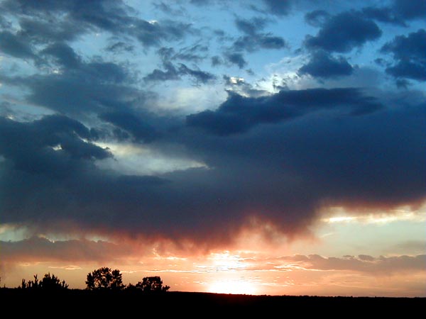
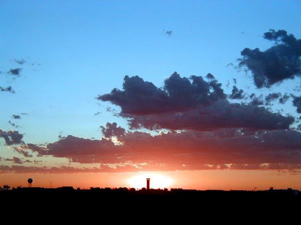
A final picture - the sun rising over the Amarillo airport.
 |