I had hiked to the summit last year by myself - a report on that hike is here.
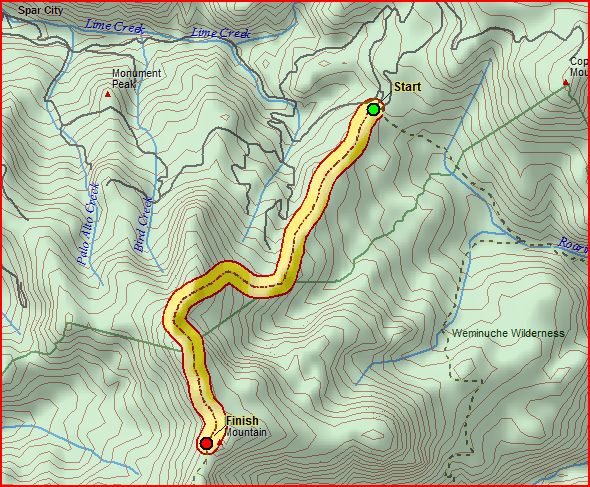
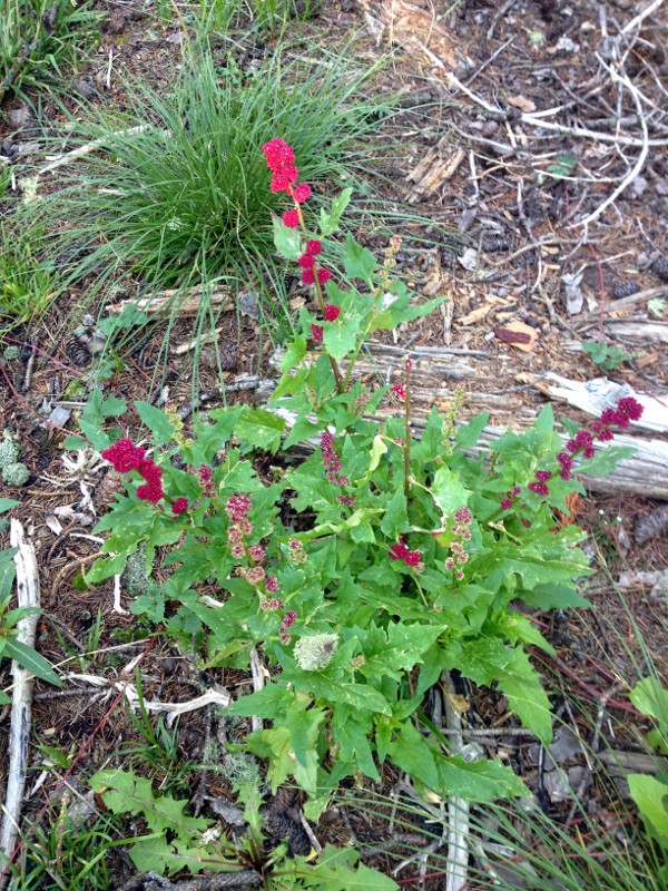
The hike is about 4.2 miles in each direction, depending on how far off the trail you get, and the trail to the summit ascends about 2500 feet. The lower part of the trail winds through a forested area with lots of wildflowers - and lots of downed trees, the latter of which make it sometimes desirable to leave the trail to bypass sections of downed timber.
We left the trailhead at about 8:25 AM.
The map of the route is below.
Here's Cindy with some of the flowers in the forested area.
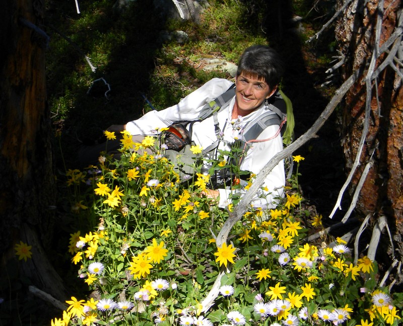
The profusion of wildflowers in that area is amazing.
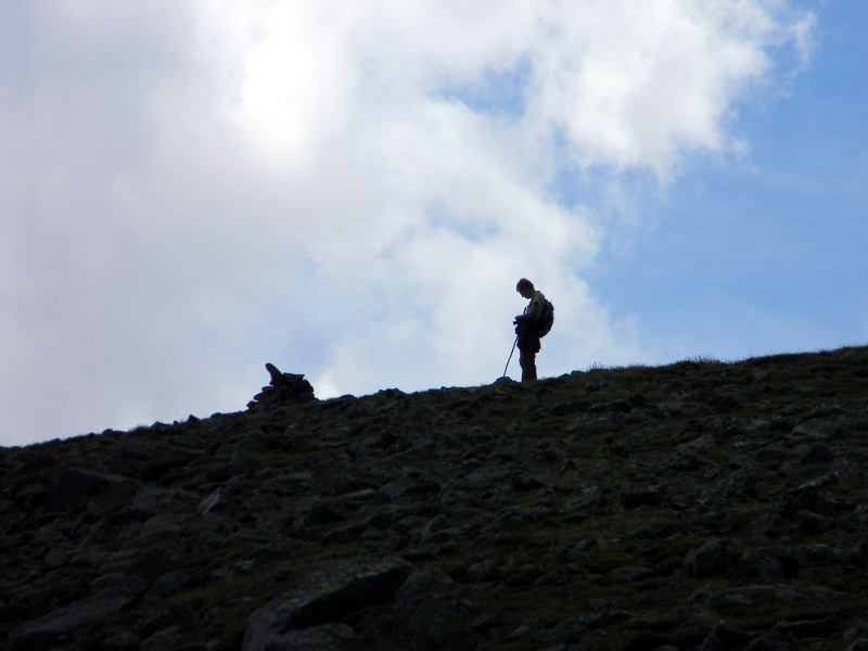
We stopped for a pack and snack break about 2 miles up the trail, then headed on up. Shortly after the break, we reached the tree line, and continued ascending. We reached a lower saddle at about 12,230 feet, then started up a slope to a high point about a mile from the summit of Fisher Mountain at about 12,625. Patsy Weems, who I think must be part mountain goat, left the rest of us behind and got to that point well before anyone else. Below is Patsy at a cairn on that climb.
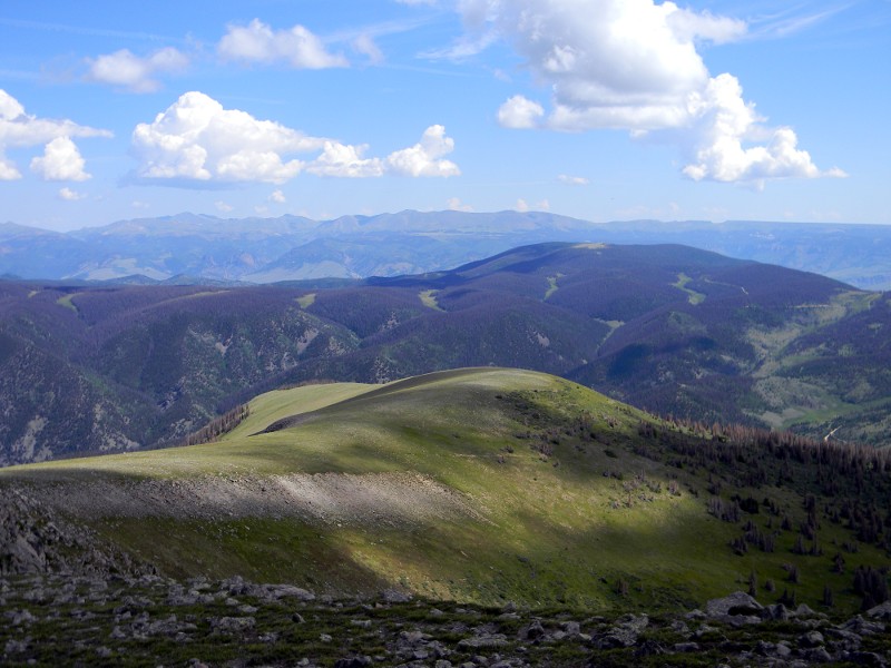
Once we got to that point, the view to the east was lovely.
The summit of Fisher Mountain was about another mile on - and down a couple of hundred feet, and then back up to the summit at about 12,870 feet.
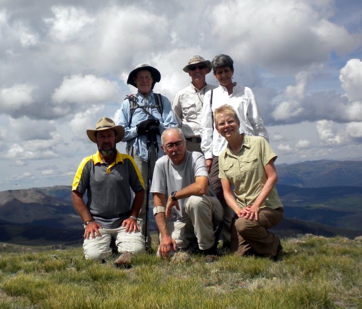
Once we reached the summit, at about 11:30 AM, we signed the trail marker, and took the obligatory summit picture.
After a discussion of the annoyance of some flying ants on the summit, we decided to ascend before eating lunch. Our decision was reinforced by a clap of thunder from some clouds off to the southeast, and we descended a bit faster than we might have otherwise.
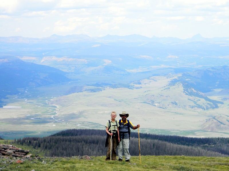
The picture below was taken to the northwest from about the 12,600 foot level, and shows very well why we do this. The river behind and below Patsy and Chuck is the Rio Grande, just a few miles from its headwaters at Rio Grande Reservoir. The peaks to the north are a good 30 miles away.
We descended another mile or so, and stopped to eat lunch. Shortly after beginning our descent from there, we started getting some little sprinkles, so we stopped to put on raingear. We never did get much rain, and eventually the sun came out, and off the raingear came.
We got sidetracked on the trail through the downed timber, and wound up on the road east of where the cars were parked, but that was an easy hike back to the cars. We were back at the park a couple of hours after noon.
Another beautiful day in the mountains with good friends. Total mileage was 8.54 miles, with around 5,000 feet of total elevation change.
We were on public lands the entire hike, so you own it, too. But you can't drive to where we were - if you want to see the views we saw, you have to get off your ass and start walking.