This file was originally written after a trip in 1999.
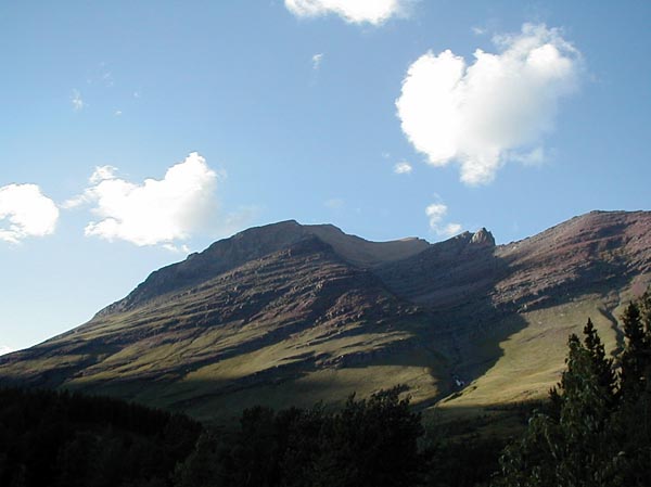
The Many Glaciers campground in Glacier
is a good starting point for numerous dayhikes. This is a ridgeline
above the campground to the north. There was a grizzly bear digging
for food up on this ridgeline two nights I was camped there, creating a
gaggle of people with spotting scopes, binoculars, and cameras in the parking
lot of the restaurant and store. He was a funny looking bear, too,
with the characteristic silvery brown color of grizzlies, except that his
behind was jet black. When he had his back to the camp, he looked
like a period up on the mountain to the naked eye.
|
|
My trail guidebook said that the hike up to Grinnell Glacier was one of the most scenic. The trailhead is just east of the campground.
The trail is about 6 miles up to the glacier,
with an elevation gain of about 1800 feet, so I loaded up my daypack, and
hit the trail about 9:00 A.M. on a gorgeous clear day. The trail
winds through some forest for about three-quarters of a mile, until it
gets to the south end of Lake Josephine, below.
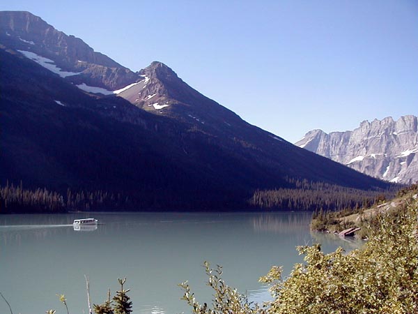 |
The trail up to Grinnell runs on the west
side of the lake, and was heavily vegetated. I was to pass within
a hundred feet or less of a grizzly bear on the return down this trail.
The boat in the picture runs from the north end of the lake up to a dock
on the south end, and takes sightseers around as well as dropping off hikers
too lazy or infirm to hike the length of the lake.
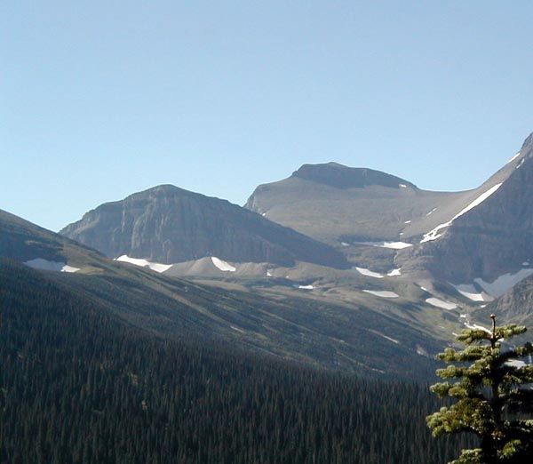 |
The view above is from the trail up toward
Piegan Pass, to the east of the glacier. There is another trail up
to that pass, which runs to the east side of Lake Josephine, and would
make a good day hike from the Going-to-the-Sun Road side of the pass back
toward Many Glaciers. There are hiker shuttle buses which run between
Many Glaciers and several of the trailheads off the road. Reservations
for the buses are a good idea.
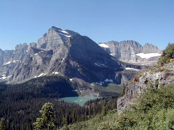 |
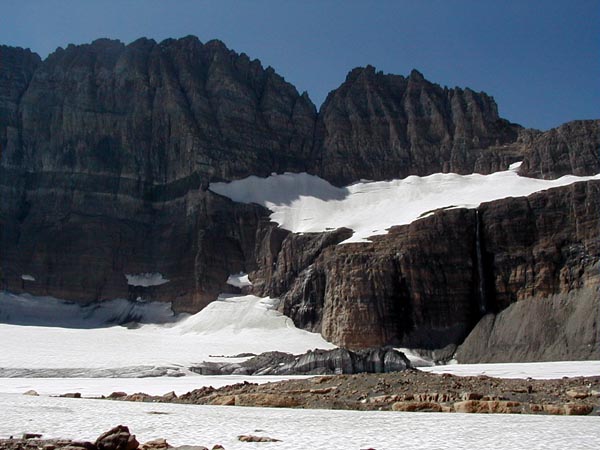
The peak in the left center of the picture
above is called Angel Wing. The lake below it is Lower Grinnell Lake.
The sheer rock wall to the right of Angel Wing has the glacier below it,
not visible from this point, and is known as the Garden Wall. I was
later to hike the Highline Trail, which runs on the other side of the wall
- see The Highline Trail.
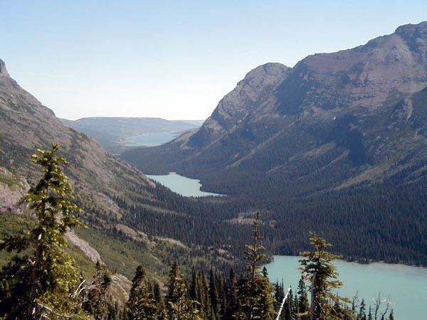 |
This is the view from higher up.
Lower Grinnel Lake is on the right, with Lake Josephine in the center,
and behind it, Swiftcurrent Lake, which is at the level of the camp.
 |
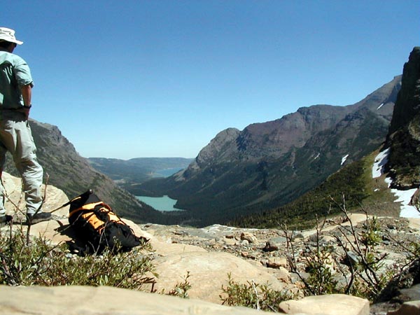
C'est moi, on the glacier overlook, with
my daypack on.
 |
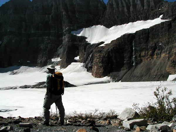
Above is the spot where I ate lunch, sitting
looking back down over the valley, or turned around looking at the glacier.
I spent a hour and a bit more sitting there, telling myself I ought to
get moving, but enjoying the views too much to do so. It took me
a bit more than three hours to get up there, so I wasn't really in any
hurry, and after I ate my lunch, with my boots off to let my feet dry out,
I wandered about in the glacial morraine for a bit, just poking about.
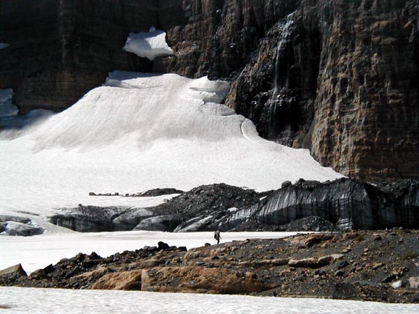 |
The hiker in the picture above is walking
around on part of the glacial morraine. Behind her is the Garden
Wall, which is better seen in the picture below.
 |
I finally hiked back down the trail. On the way up, I noticed that there was a lot of vegetation, including bushes with berries on them, around Lake Josephine, so I took my special high-tech bear warning device, a Pepsi can with three pebbles in it, and made a lot of noise going down the trail. When I got down to the boat dock on the far end of the lake, I noticed a lot of people standing on the dock, pointing at a grizzly just above the trail I had walked down. They told me the bear had been in the water, and had gotten out and moved back above the trail just before I walked down it. Good timing. I'm glad I wasn't moving any faster.
I feel sorry for people who believe they
can see Glacier in a day, without getting off of a paved surface.
They miss so much of the park that way. Hiking in the backcountry
takes equipment - see my dayhike pack
list - and effort. It's worth it. The best parts of the
park can't be seen from the roads.